![]()
![]()
![]()
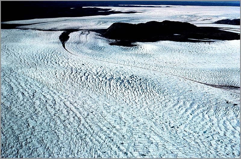
Greenland
Ice Cap 1959
|
|
|
|
|
|
|
Photo by William M. Nichols, 61st TCS Pilot |
|
Sondrestrom AB, Greenland. Between the bare terrain along the coastal perimeter and
the smooth ice cap is a 25 to 75 mile area of crevasses called the marginal
zone. The mountain poking up the
glacier is called a nunatak. The
rough surface of the glacier here is due to the crevasses and pressure ridges
caused by the flow outward from the center of the glacier towards the coastal
area. Pressure exerted against
the nunataks and coastal mountains and normal dipping of the underlying
terrain towards the lower coastal regions cause the semi-ridged ice mass to
buckle and fracture. Caption
by Bill Nichols. (Circa 1959) |
|